COTS GPS tracking apps

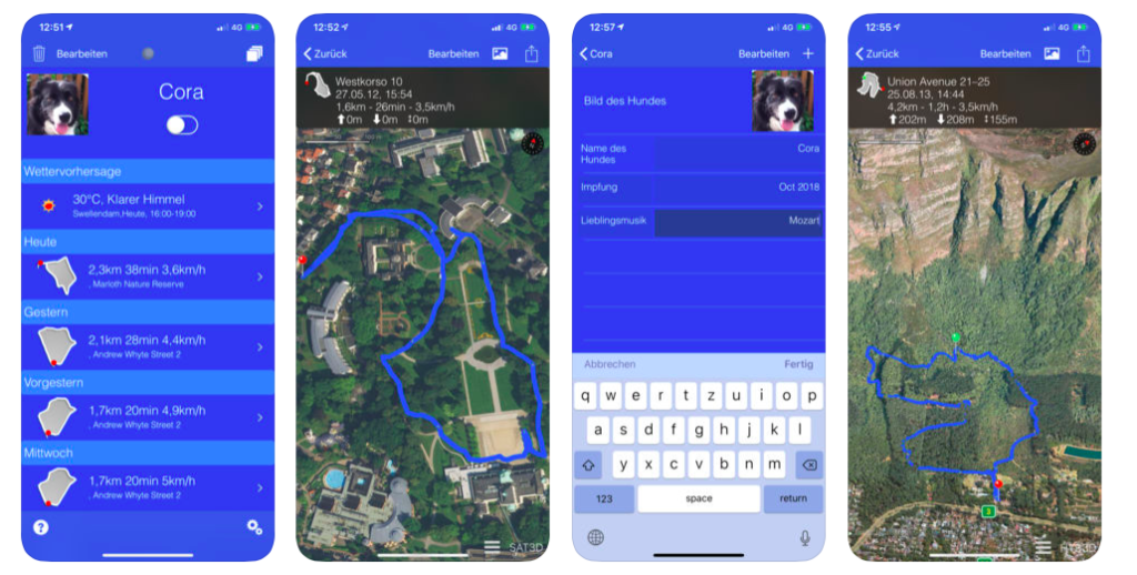
A range of both purposed wearables and smartphone apps are available for humans. A number of fitbit type wearables now available for dogs. Generally these are designed with similar purpose to fitbit and focus on health and activity.

We wanted something that we could use as a basis for our own data collection and which we could hack to explore ways of adding the experience for both walker and companion animal. dogwalk personal turned out to be the most useful COTS option for the early design work.

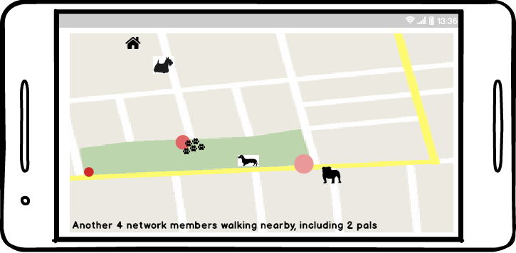
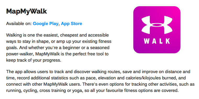
Map my walk – standard route tracking with purposed stats (speed, pace, elevation) for human walkers. Walk sharing and connection is encouraged but it all takes place within the proprietary space of the app itself and is situated in the placeless-ness of cyberspace.

Tractive Dog Walk – purposed for the dog walker. Live GPS route with nice buttons to add daily business (D1 and D2) and photos.

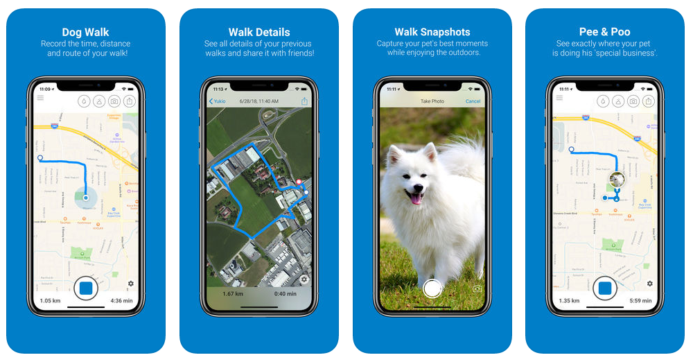
The Tractive ‘dog experience’ additions are nice and easy to use although limited to the two specific types of daily business experience. Tractive only exports a .pm file which is basically a batch file for the app and contains no GPS route data. Friend sharing options are available but use facebook.

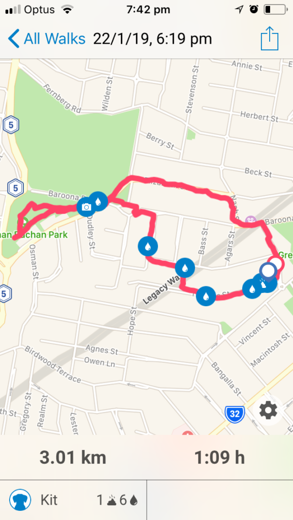
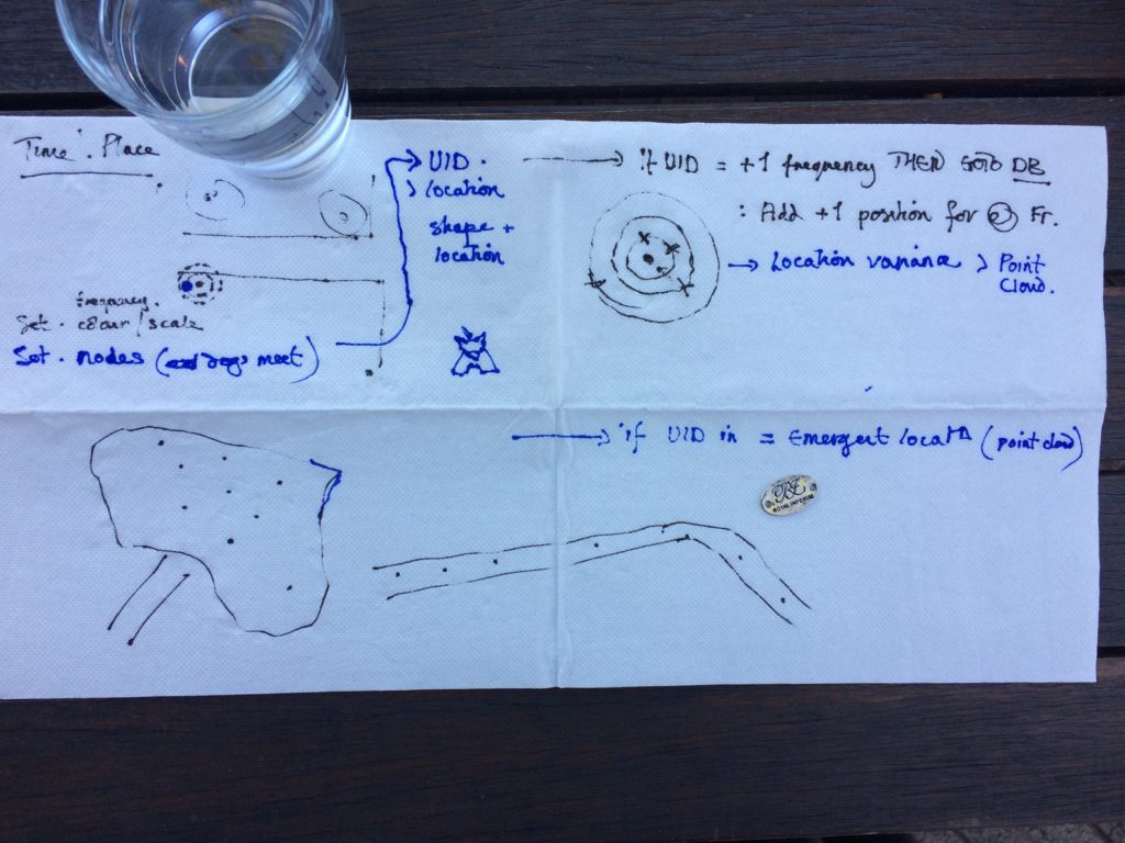
dogwalk personal by-grapevine-cottage: purposed dog walk GPS tracking with options to drop waypoints and add notes. Exports as a GPX file which can be used in other GPS visualisation software.

iphone version and Android(update – no android version?)

dogwalk lacks the quick and easy specific waypoint function of Tractive but does allow a variety of different waypoint experiences to be added. The GPX file export option means that these can then be transferred to other apps and treated.

First dogwalk test using early tag list (PW = Person Wait) exported into GPX viewer

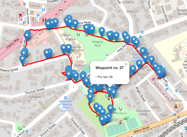
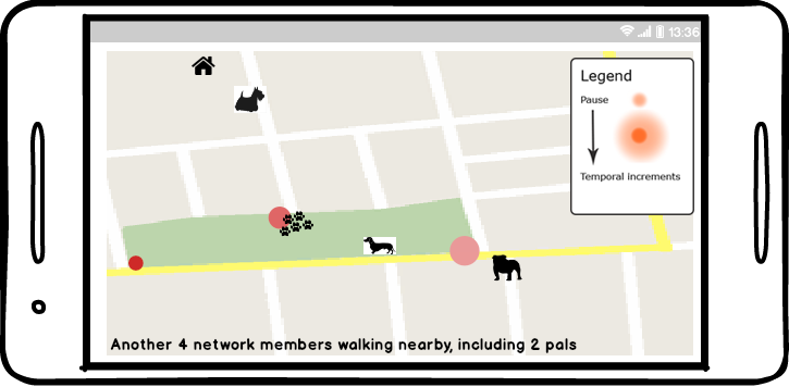
See Devblog for more details about the waypoint tags and treatment

Early design concepts: scenarios

The very first design concepts used the following scenarios:

Let us imagine the following, based on a hopefully rare personal experience. A senior walker, who lives on their own, is walking the dog on a rainy day. They slip on the wet road and break an ankle. Fortunately, there are others around who render assistance. But what about the dog? There is no-one home to call and the helpful people who called the ambulance don’t stay around once it arrives. This is where a trusted network of community dog walkers might rally round. As we tend to walk our companion animals at regular times of day and see the same walkers, the chances are they will be nearby and will know the walker and their dog and come to their aid.

A second scenario considers community support and companionship. Many urban parks offer fenced dog park areas that often are busy social locations. However dog parks are not without issues, particularly for the older walker. Apart from often being accessible only by car, many are merely fenced enclosures where there is no guaranteed control, resulting in potential risks to dogs and people. A supportive network of walkers might alleviate this.

Another scenario that would be facilitated by a trusted network is the option to find company and perhaps go on more adventurous walks as a result. Many of us tend to walk the same routes but having a walking companion could lead to exploring further afield. In addition, having a companion walker might lead to a pause in the walk, perhaps stopping for a coffee, or sitting in a pleasant spot to enjoy a view. We often share these new pathways and their opportunities for pauses with other walkers we meet.

Exploring new pathways leads to yet another scenario, one also arising in personal experience. Some sites that are ideal for walking are isolated by virtue of road networks and travel systems. For example there is a wonderful old graveyard at the top of the hill in my own locale but access to it requires crossing an extremely busy fast access road to the highway. There are also convenient river side walks nearby but some stretches of these walks are essentially fast bicycle highways and highly inappropriate for the walker. Both of these access issues could be ameliorated if there were dog friendly public transport periods. The graveyard could be accessed by bus, the quieter parks on the riverside walk could be accessed via river transport. A network of dog walkers could provide the beginnings of a community consultation / mobilisation group.

The design scenarios echo Foth and Guaralda (2017) who point out that ‘people are natural place-makers’ and that place-making community connection, health and well-being are improved through fostering natural place-making.  Natural place-making also fosters a more collaborative engagement between people and administrative bodies (consider the residents who know an area well enough to have the confidence to discuss future plans with a local counselor). Critically, ‘natural’ place-making must be allowed to occur rather than being designed and deposited. Place-making is a grass roots activity. It must emerge out of community participation. Data and participatory mapping for community and place-making is not new. Since de Certeau’s insights (1984) into the practices of urban dwellers as they re-make the conceived space of the designed city according to their own living needs and routines, we have tried to use design to construct space and turn it into place.

Backstory

The Pathways project begins with companion animals and the delight of the co-performance of the dog walk.

Walking with a companion animal in the self same locality that I had walked around for decades was a distinct and different experience.

The Pathways and Paws(es) backstory begins with a personal desire to get a dog for company because the family had all grown up and left home and recognition that I needed some kind of structure to engage in physical activity. The importance of companion animals and regular physical activity is well known, particularly with reference to active aging. Ensuring capacity for animal companionship for seniors is not without its dilemmas but the importance of facilitating companionship for health and well-being can be seen in the number of enterprises which aim to foster change towards more pet-friendly environments.

Engaging with the inner urban neighborhood as “co-performing” partnership changes a number of experiences. The most obvious being the exchanges with other people during the walk, People stop and greet you through the medium of the dog. This phenomenon is perhaps in part due to the fact that my dog is pretty cute and looks not unlike Hairy Maclary of Donaldson’s Dairy fame, and in part due to the different paths one takes with a dog (through parks where families gather), but it adds up to what Lisa Wood calls social lubrication and strengthened social capital.

That pets can help build social capital is not just a social nicety or quirky sociological observation. Hundreds of studies internationally show that social capital is a positive predictor for a raft of important social indicators, including mental health, education, crime deterrence, and community safety.

The very first Pathways and Paws(es) project concepts were all about facilitating a locality-based dog walker’s network. The core concept was that access to a place-based network of other (known) walkers would both facilitate social interaction (someone to walk with perhaps) and provide some sense of additional security, someone known and nearby to ping in the event of an emergency.

Early design concept of smart phone app showing known network members walking nearby

We were focused on the idea of place-based communities for the network and wanted to avoid a network constructed in the placeless-ness of cyberspace and this led us into consideration of slow cities and the importance of creating place through grass roots activity. The designing started with some scenarios.

And a review of currently available commercial off-the-shelf (COTS) GPS tracking apps.

There are numerous off the shelf GPS apps that could be used as a basis for such a network but they tend to show the path taken and so flatten the actual experience of the journey. We wanted to show the ‘pauses’ – places where conversations have taken place or where the walker has stopped to allow their companion animal do engage in animal business.

Sketch showing how GPS tracking might show time spent (nodes) as opposed to path taken

We wrote about this phase of the design work.